Welcome to our Community Council website.
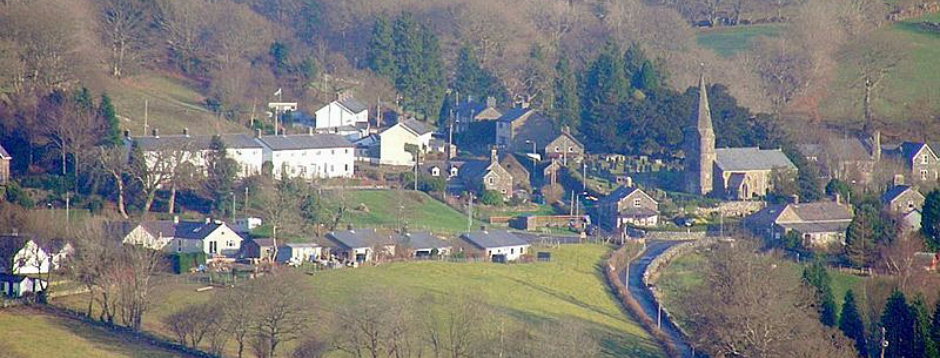
An extensive part of the old county of Meirionnydd forms the territory of the Council, extending from the banks of the Mawddach in the North West and the watershed between the two rivers, Wnion and Dyfrdwy in the North East; it then follows the line of mountains South Eastwards, from Aran Fawddwy towards the foothills of the Cader Range, and thence to the vicinity of Dolgellau to the South. The mostly rough and uneven, high, rural landscape makes up most of the area, which is generally suitable for sheep farming. Originally three separate communities centred around the villages of Llanfachreth, Brithdir and Rhydymain, they have since been united to form a larger unit, with Council meetings being held at all three centres in rotation.
As was the custom in former years, the area contained a number of stately homes, each one having its private estate, of which the largest and most important was the Nannau estate, but there were also several other smaller ones. All this has changed by the present time, the properties being owned by their occupiers and nearly all the stately homes having been developed for various purposes. The once all-important mansion at Nannau is empty and lifeless. Some notable features within the area should be mentioned, most of them, sadly, in bygone days: copper and gold mines at Glasdir and Ceunant Hyll, and later a flourishing milk factory at Rhydymain providing many people with a decent livelihood. At the village of Brithdir the remains of a Roman establishment have been discovered, which appears to have been central to the three other forts situated in Meirionnydd, i.e. Tomen y Mur (Trawsfynydd), Caergai (Llanuwchllyn) and Cefn Caer (Pennal). Today the main industries are agriculture and forestry, both being, in terms of employees, a mere shadow of former times.
In these pages you can get an overview of what the Council does as well as obtaining some useful information about the area.


